
The Via Consolare Project in Pompeii
 |
||||||||
|
The Via Consolare Project in Pompeii
| ||||||||
| Home | Research | Internships | Team | Links | Contact | |||
| Summary | 2005/2006 | 2007 | 2008 | 2009 | 2010 | 2011 | 2012 | 2013 | 2014 | 2015 | 2016 | 2017 | 2018 | VCP 3D |
| 2019 |
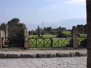

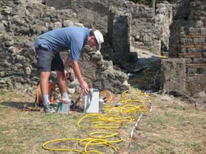 Insula VII.6 overview and geophysical research in action
|
Field Season 2007 Between the 21st of June and the 29th of July 2007, with the kind permission of the Soprintendenza Archeologica di Pompei, the continued support of professore Guzzo and dottore D’Ambrosio and funding from the Office of International Programs and the Center for Teaching and Faculty Development at San Francisco State University, the Project carried out further research in the area of insula VII.6, the area of the Villa delle Colonne a mosaico and the via Consolare. The following presents a brief summary of the activities of this field season, initial observations and a statement of the Project's planned future research directions for the summer of 2008. The 2007 research season saw the completion not only of all intended goals, but also accomplished a number of additional tasks that will facilitate research in the following years. The team completed a detailed 3-D survey of insula VII.6, providing a much more accurate plan than was previously available. In addition, 75% of the currently standing remains were studied intensively, including a detailed examination and documentation of visible construction events and mortar characteristics. These walls were also recorded using rectified photography, a method that provides a considerably more accurate and detailed representation of the standing remains than possible via conventional drawing methods. The initial analysis of the remaining areas of the insula, the area of the Villa delle Colonne a mosaico and the length of the via Consolare are to be completed during the summer of 2008. In addition, extensive geophysical research was undertaken within both insula VII.6 and the area of the Villa delle Colonne a mosaico using two different geophysical techniques. These were undertaken in order to answer specific questions which evolved from our analysis of the standing remains and to test important hypotheses related to our research on the early via Consolare and the development of the city of Pompeii. The first method involved readings taken along eight ‘pseudo-sections’ via electrical resistivity tomography. Each of these provides a view through the subsurface, allowing for the identification of buried structures, voids, floors, and surviving stratigraphy, to a depth of up to 2.5 metres. The second method employed a magnetometer to examine all open areas for metal objects, areas of burning or other geophysical anomalies in the subsurface deposits. In addition, this method would have also identified the location of any unexploded bombs potentially remaining in the ground from Allied bombing in 1943 (fortunately none were observed). |
|
3D Topographic Survey
All team members participated in a detailed topographic survey of insula VII.6 using a Leica TPS805 Power Total Station. The measurements were keyed into the pre-existing SAP geo-reference points as employed by excavations by the University of Bradford (AAPP) in insula VI.1. The model of the insula is accurate to ± 2cm and preserves the dimensions of all currently standing walls in the insula in three dimensions, the locations of large and cumbersome debris, and the presence of features present on the ground surface and current soil levels. The model involves over 30,000 individual measurements which are accurately geo-referenced and will be coordinated in AutoCAD as a DXF solid polygon and wire-frame model, combined with the survey information which we acquired in the Villa delle Colonne a mosaico in 2006. This model will serve to coordinate all future research by providing an accurate plan of our areas of research and the basis for plans and drawings. Furthermore, it will be possible to integrate the model with the 3D scanning proposed for the Casa della Diana by Professor Luzón et al. of the Universidad Complutense de Madrid. |
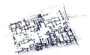
|
|
Stratigraphic Walls Analysis and Recording via Rectified Photography
Each available standing wall was examined closely for information on the sequence of their building and development. The colour, composition and inclusions of each mortar used in every construction event, overlying and underlying relationships and the overall sequence of development of each area of the insula was acquired through intensive study of each face of every standing wall. Furthermore, an innovative method of wall recording was developed during the course of this field season employing high-resolution digital photography and computer aided rectification. This produces scaled image of each wall surface and may replace completely earlier methods involving drawings produced by hand. Stratigraphic analyses are then traced upon these images producing an extremly accurate record of the standing remains and their phases. Furthermore, the exact position, colour and texture of each stone, mortar and wall features are recorded and may be examined in detail at any future date. Roughly 80% of the standing walls have been photographed in this manner and will be rectified throughout the rest of the year. This information has been coordinated into a preliminary phasing sequence that explains the process of urban development in the insula. This has suggested a number of interesting interpretations as well as raising a significant number of important new questions. These will be examined further in the future, hopefully accompanied by targeted excavation in the summer of 2008 or 2009. |
|
Initial Interpretations and Further Questions
The Project's work in 2007 revealed a number of interesting details about insula VII.6, the Villa delle Colonne a mosaico and the probable course of the ancient via Consolare. Of course, these initial interpretations will require further research and comparison with the geo-physical results before they can be confirmed. However, they serve not only to highlight the potential of the insula for providing a more complete understanding of the city’s development, but also underscore the necessity for continued work in these areas of the city. Insula VII.6 contains traces of a long history of development, growth and modification. Its earliest walls, built in Peterse’s opus africanum type A, predate the introduction of lime into Italian building and can clearly be seen to be mortared together with clay only. At the same time, much of the standing masonry is of a relatively late date, particularly the Casa di Petutius Quintio (VII, 6.30.37) which is almost entirely constructed in opus vittatum, opus mixtum and brickwork. Even the apparently early walls of the Casa di Secundus Tyrannus Fortunatus (VII, 6.28.19.20) appear to be a reworking of earlier walls of opus africanum, dated roughly to the beginning of the Augustan period. The walls of the insula further contain hints of major changes of alignment, internal organisation and function. A complete documentation and interpretations of these changes will reveal much about the history of the city and changing priorities of property owners. The alignments of the insula itself are interesting and challenge numerous previous interpretations of the early city plan, the early course of the via Consolare and the functional role of this insula within the early city of Pompeii. Further work on the precise meaning of the probable original plot boundaries, will await further analysis with the final processing of our newly surveyed plan as described above. As always we thank the Soprintendenza Archeologica di Pompei, professore Guzzo and dottore D’Ambrosio for their kind and continued support and encouragement in our research activities and look foward to the 2008 field season. |
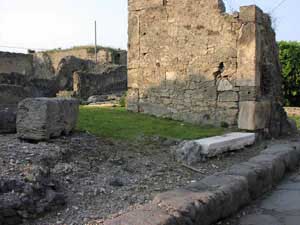
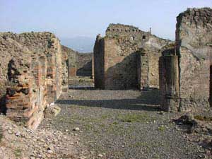 Various views of the southern part of Insula VII.6
|
|
Website Content © Copyright Via Consolare Project 2018
| ||||||||